Through the Lands of the Lost Villages (a talk by Jim Brownell
March 2020 – Newsletter Issue #2
Jim Brownell, President of the Lost Villages Historical Society [LVHS], took us on an armchair tour “Through the Lands of the Lost Villages”.
We started on August 10, 1954, when Prime Minister Louis St. Laurent, New York Governor Thomas Dewey, and Ontario Premier Leslie Frost turned the sod at Maple Grove to mark the beginning of development of the St. Lawrence Seaway, to bring ocean-going ships up the St. Lawrence River, and a massive Ontario Hydro Project to create much more electrical power from the Moses-Saunders Dam at Cornwall. Power stations on both side of the river benefited, but communities in Ontario and one inhabited town, Louisville Landing, on the U.S. side of the river, were destroyed.
Maple Grove was the eastern-most community to be lost. It held the home of Jeremiah French UEL who served in the King’s Royal Regiment of New York. He later sold the house to his sonin-law George Robertson UEL. The French-Robertson house is now at Upper Canada Village [UCV] near Morrisburg, and one learns that walls of the original log cabin form the dining room.
In total, 531 houses were moved by Ontario Hydro from their original locations to newly created towns of Ingleside and Long Sault, and to Upper Canada Village. Only three churches were moved: Christ Church Anglican from Moulinette is also in UCV; Holy Trinity Anglican from “The Churches” was moved to Riverside Heights, stone by stone, and reassembled; a third church, Emmanuel Pentecostal Church, was moved from Mille Roches to Cornwall, but has since been demolished. All other buildings – factories, train stations, homes, churches, stores – anything deemed not structurally sound enough to be moved – were destroyed, either knocked down with a wrecking ball or burned. National Research Council scientists studied how fires spread when houses were burned in Aultsville and Wales, gaining valuable information that led to regulations for smoke detectors and sprinkler systems and changes to building codes.
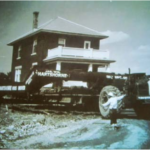 Jim showed the most photographed house being moved, the former Hugh and Alice Warner house. He mentioned that Mrs. Warner had inadvertently left china plates on the mantel before the move, and they arrived at the new location in Long Sault still intact. Jim even owned this house for a while, some years afterward.
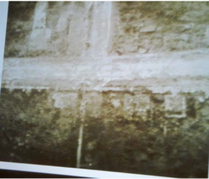
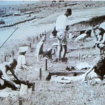 There were some archaeological digs prior to the move, this one on Sheek Island.
At Moulinette, St. Andrew’s Methodist Church, dating from 1834, was torched. The gravestones were removed from its cemetery to a new union cemetery near Long Sault, and the
graves were then capped with six more feet of soil and rocks.
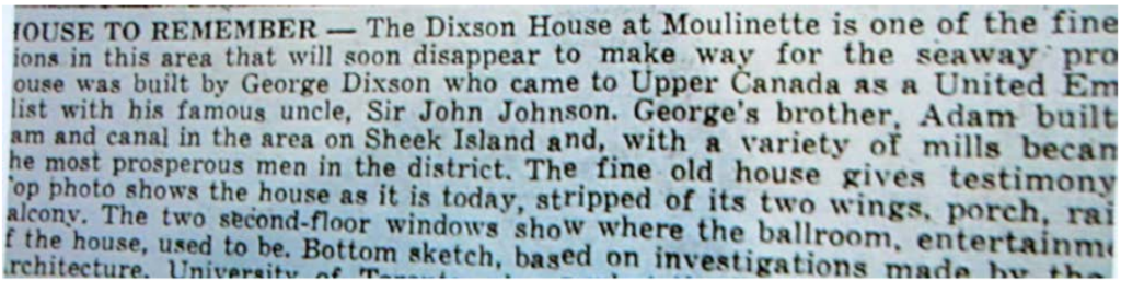
The house of Loyalist George Dixson was destroyed. This caption accompanied a newspaper sketch of the house:
The register from the Connelly Hotel in Wales is at the LVHS Museum, as are lists providing the names of those who were displaced. The home of Loyalist Dr. James Stuart was moved to a higher location on the old Stuart tract, at the time of the relocation, then moved a second time, to become a heritage structure at the LVHS Museum.
 Photographer Louis Helbig has taken recent aerial photos showing that the road system and building foundations of Aultsville can clearly be seen looking down through the water from a small aircraft.
In total, over 6,500 people were relocated. Inundation Day was July 1, 1958, when the last cofferdam was blown up. It took four days for water to flow over the villages, creating Lake St. Lawrence and completing the St. Lawrence Seaway.
Jim recommended some books for additional information: Lost Villages, Found Communities: A Pictorial History of the Lost Villages of the St. Lawrence Seaway by Anne-Marie Shields, and Voices from the Lost Villages by Rosemary Rutley. Many photos and interesting stories can also be found on the website https://lostvillages.ca/.
The names of the Lost Villages are: Aultsville, Moulinette, Dickinson’s Landing, Santa Cruz, Farran’s Point, Sheek’s Island, Maple Grove, Wales, Mille Roches, and Woodlands